Note: At the time of this writing, fire danger is extremely high in southern Colorado, and a number of wildfires are burning throughout the region. Be aware of where fires are occurring, where red-flag warnings are posted and any travel or fire restrictions. Also, monsoon season is fast upon us, so be aware of increased storm activity, including lightning. Check weather forecasts, start early, get off of high mountain peaks by early afternoon, and if lightning flashes, get indoors.
Continuing with my series this summer of “Road Trip” hikes I think you should try, this week I’m going to throw a real doozy at you.
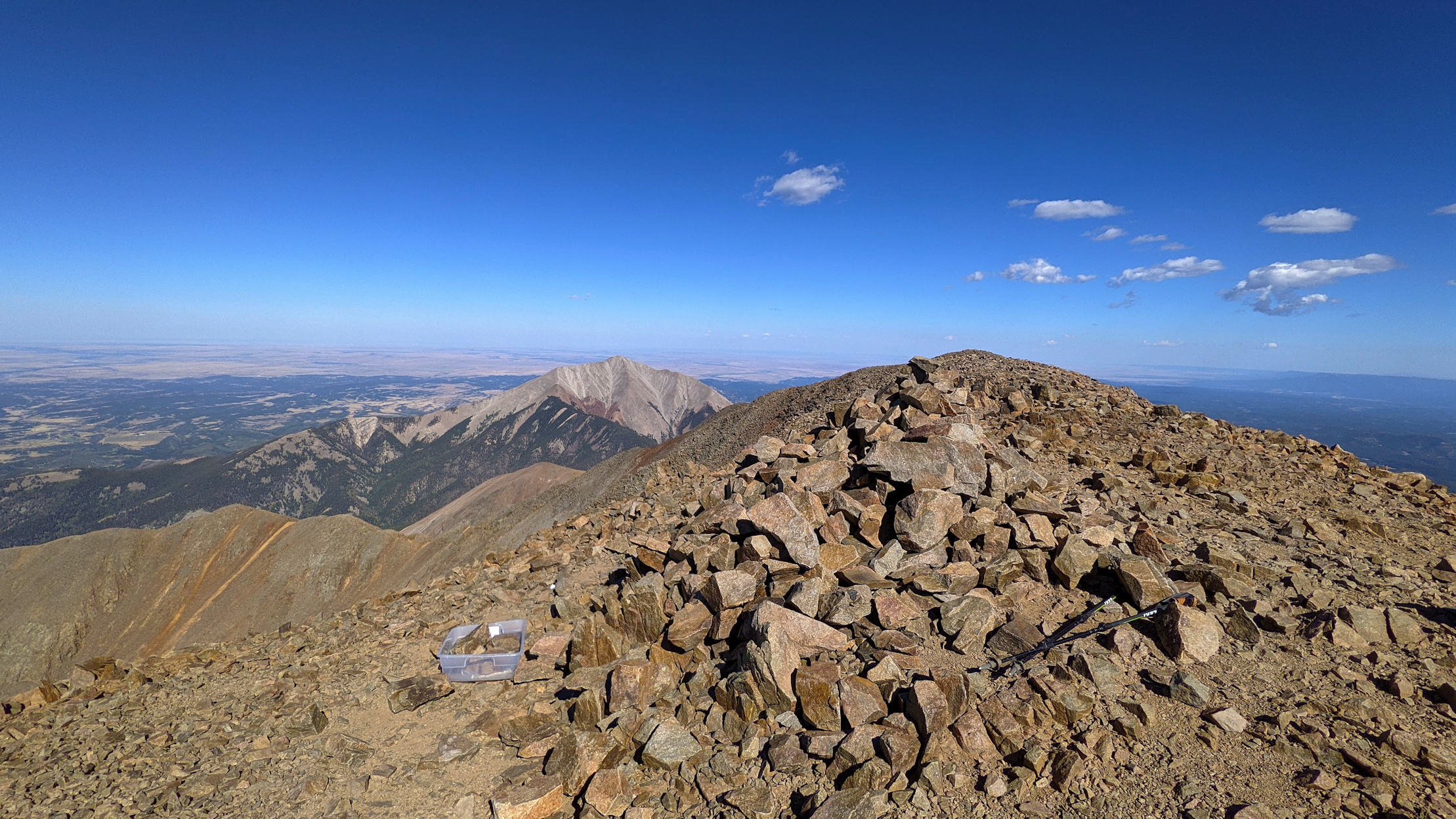
The Spanish Peaks rise out of southern Colorado, west of Trinidad and about 25 miles north of the New Mexico border. They are the inescapable peaks you see when driving south on I-25, off to the west, and although it doesn’t look like it from afar, the west peak, at around 13,600’ is about 1,000’ higher than the east peak. The exact height of the of the west peak is a bit questionable, with the state’s Colorado Trails Explorer (COTREX) map showing it at 13,583’, the CalTopo map I use with my GPS showing 13,626’ and Wikipedia saying it’s 13,631’. Given how close CalTopo and Wikipedia are, I’m inclined to go with it being more than 13,600’ high. The west peak also enjoys the honor of being the eastern most peak above 13,000’ in the United States. There is a trail to the top of the west peak, but not one to the top of the east peak.
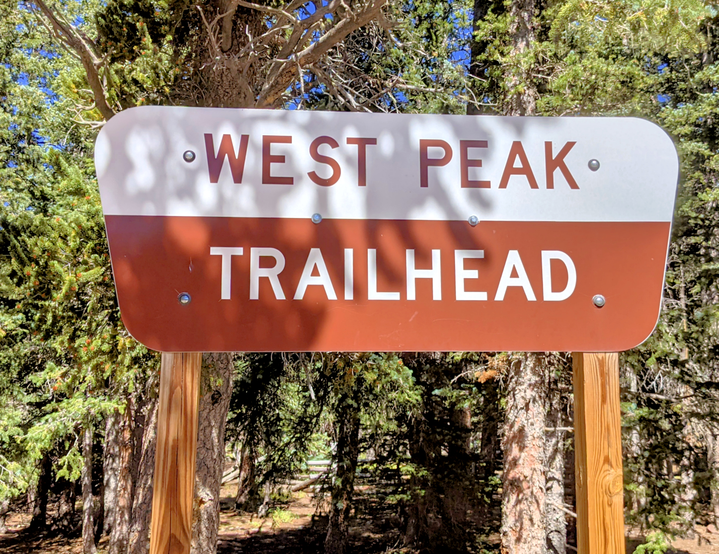
The West Peak Trail/Forest Service Trail 1390 starts at the top of Cordova Pass at the Cordova Summit Trailhead. At an elevation of around 11,250’ (again, give or take), the trail starts out fairly easily as it makes its way towards the tree line. It winds easily through the trees for almost 1.75 miles to where it intersects with the Apishapa Trail #1324. Bear left here, staying on the West Peak Trail, as it starts an uphill climb through a series of switchbacks, until you break out of the tree line and things get, well, interesting.
From here the trail gains more than 1,600’ in little more than a mile of fist-sized rocks that want to twist your ankle or your knee on every step. There is a kind of “trail” here, so you won’t be just free-ranging up a rocky slope, but you will need to watch carefully so you don’t wander off the trail.
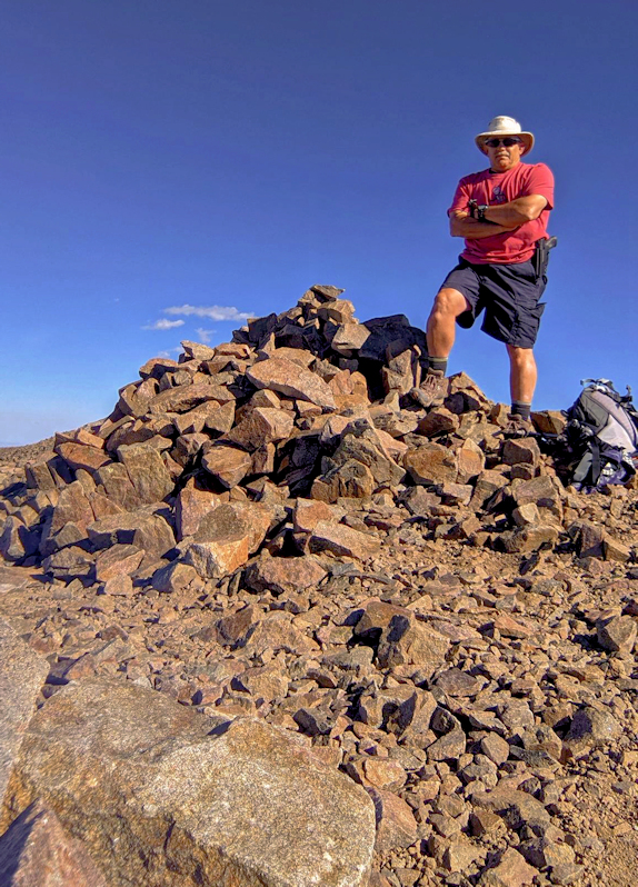
By now I’ve probably made this trail so enticing, you can’t wait to go and do it. But wait, there’s more! The views from the top are, of course, breathtaking. And since it’s not one of our state’s many ballyhooed 14,000’ peaks, it doesn’t attract the attention that they do, so you likely won’t have to endure the throngs of people who clog some of our 14er’s trails, such as the conga lines of people on Mt Bierstadt or Quandary Peak. And heck, it’s almost a 14er, so if you want to fudge the numbers a bit and tell people you did one, go ahead. I won’t spill the beans on you. And, if you get to the tree line and decide you don’t want to climb to the summit, then turn around. The hike to the tree line and back itself is pretty nice.
The total round trip distance for this hike is about 7.75 miles, with more than 2,500’ of ascent.
For more information on the West Peak Trail, go COTREX: https://trails.colorado.gov/trails/west-peak-11537
To get there: From Highway 160 west of Walsenburg, turn south on Highway 12 – a very nice scenic highway – and take it through La Veta and then through the town of Cuchara. At the very top of Cuchara Pass, turn left onto County Road 46/Cordova Pass Road until you reach the summit of Cordova Pass. The trailhead is well marked, and Cordova Pass Road is suitable for any vehicle. Travel time from Colorado Springs is around 2.5 hours.
When you’re done with the hike and on your way home, stop in Cuchara for a bite to eat.
Be Good. Do Good Things. Explore.
Bob Falcone aka “Hiking Bob” has been a Colorado Springs resident for 35 years. A retired career firefighter and U.S. Air Force veteran, Bob is an avid hiker & outdoorsman. Bob spends his days traveling around Colorado and the American Southwest searching for hiking and photography opportunities and adventures, often with his loyal companion Coal the dog. Be sure to check out Hiking Bob’s website and podcast.